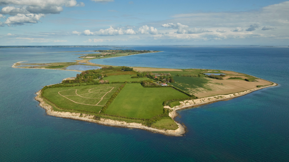
Drejø
Visit Drejø
To get to Drejø, you need to take the ferry Højestene, which sails from Svendborg and passes Skarø before arriving at Drejø. The journey takes about 1 hour and 20 minutes, and during the trip, you'll enjoy a beautiful view over the South Funen Archipelago.
What to experience on Drejø
The island is equidistant from Ærø, Fyn, and Tåsinge, hence the expression that Drejø is "in the middle of the world." Drejø By is an idyllic village with several beautiful half-timbered houses and farms that survived a major fire in 1942. It is said that an careless roofer, who knocked out his pipe, was to blame for the fire.
The island offers good fishing opportunities, beautiful salt marshes, and lovely beaches. Here, you'll find an inn, grocery store, campsite, local museum, café, and several farm shops selling locally produced goods. Gammel Havn on the north side is a unique, atmospheric, and well-preserved harbor from the days when there was fishing and freight shipping from the harbor. Although there are only 10-15 guest berths on paper, there can be 20-25 boats gathered in the harbor on a good summer evening, and there are good facilities for sailors and kayakers. Showers, toilets, kitchen, bonfire area, and a small campsite can be used by the harbor's guests.
Geological perspectives on Drejø
Since the sea entered the area south of Fyn after the last ice age and created the South Funen Archipelago, Drejø's glacial landscape has been eroded. This is most evident along the cliffs at Næbbesodde. The loosened clay, sand, and gravel are carried by coastal currents to calmer waters, where the material is deposited, creating new land - marine foreland.
The largest areas of marine foreland are found along Drejø's shallow north coast around Mejlhoved, Drejet, Madekrog, Vigen, and Høllehoved. It is a mosaic of salt marshes, lagoons, beach ridges, promontories, and two tombolo formations - namely Drejet between Drejø and Skoven and a smaller one between Høllehoved and Knappen, whose core consists of meltwater deposits from the ice age. The western part of Drejet has now merged with the marine foreland at Digerne and Mejlhoved. At the tip of Mejlhoved Odde and Knappen, small spit formations are sometimes seen.
Between Mejlhoved and Skoven lies a small remnant of the submerged glacial landscape, which, like a small island in the shallow water, has helped to control the formation of Mejlhoved's marine foreland. For the sake of breeding birds, one should not walk on the salt marshes at Drejet and Mejlhoved from April 1 to July 15.
Drejø is part of the South Funen Archipelago Geopark
In 2018, Svendborg, Faaborg-Midtfyn, Langeland, and Ærø decided to establish the South Funen Archipelago Geopark with the aim of being designated a UNESCO Global Geopark. The purpose of the geopark is to create and preserve an area for both people and nature.
A UNESCO Global Geopark should highlight the geology, nature, and cultural history of an area and convey a message that humans are part of life on earth. That we are all dependent on the Earth's resources, affected by climate change, and responsible for sustainable development.
The South Funen Archipelago Geopark tells the story of a dramatic rise in sea level in South Fyn and the islands. A rise in sea level that shaped a very special nature, which for the last almost 10,000 years has laid the foundation for the existence and cultural identity of the area. It is the story of how the landscape and archipelago continue to change and define how we as humans live today. And the South Funen Archipelago Geopark is primarily about understanding how through sustainable development we can continue to protect our special geological, biological, and cultural heritage.